
Cheorwon topographic map
Interactive map
Click on the map to display elevation.
About this map
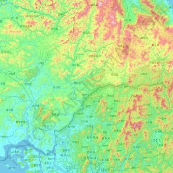
Name: Cheorwon topographic map, elevation, terrain.
Location: Cheorwon, Kangwon, Corée du Nord (37.61218 126.30370 39.01218 127.70370)
Average elevation: 299 m
Minimum elevation: 0 m
Maximum elevation: 1,560 m