
La Suerte topographic map
Interactive map
Click on the map to display elevation.
About this map
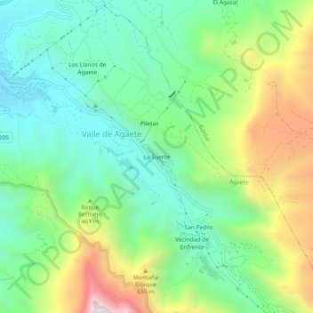
Name: La Suerte topographic map, elevation, terrain.
Location: La Suerte, Agaete, Las Palmas, Canarias, 35489, España (28.07010 -15.69760 28.11010 -15.65760)
Average elevation: 376 m
Minimum elevation: 41 m
Maximum elevation: 1,043 m
Other topographic maps
Click on a map to view its topography, its elevation and its terrain.