
Picoitos topographic map
Interactive map
Click on the map to display elevation.
About this map
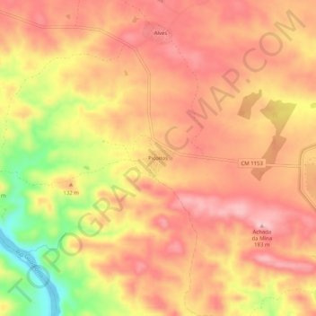
Name: Picoitos topographic map, elevation, terrain.
Location: Picoitos, Santana de Cambas, Mértola, Beja, 7750-410, Portugal (37.56959 -7.58535 37.60959 -7.54535)
Average elevation: 119 m
Minimum elevation: 2 m
Maximum elevation: 178 m