Geolocate

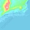
Tasik Kompleks Sukan Sandakan topographic map

Click on the map to display elevation.

About this map

Name: Tasik Kompleks Sukan Sandakan topographic map, elevation, terrain.

Location: Tasik Kompleks Sukan Sandakan, Sandakan, Sandakan District, Sandakan Division, Sabah, Malaysia (5.84709 118.04983 5.84978 118.05177)

Average elevation: 25 m

Minimum elevation: 6 m

Maximum elevation: 104 m

Other topographic maps

Click on a map to view its topography, its elevation and its terrain.
Gear up for your next adventure:

🔋Solar Chargers - Eco-friendly charging solutions for outdoor use
🥾Men's Waterproof Hiking Boots - Durable footwear with deep lugs for muddy and rocky UK terrains
⛺Lightweight Tents - Compact tents for backpacking and trekking
🧗Locking Carabiners - Secure gear to your pack or for light technical use
🔥Reusable Hand Warmers - Maintain dexterity in your fingers for precise map handling

As an Amazon Associate, this site earns from qualifying purchases at no extra cost to you.