
Geeser Bach topographic map
Interactive map
Click on the map to display elevation.
About this map
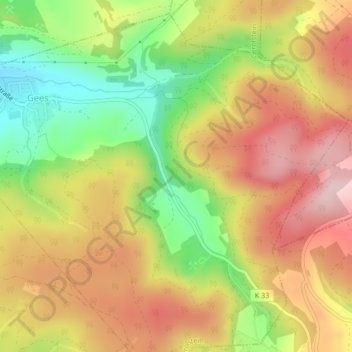
Name: Geeser Bach topographic map, elevation, terrain.
Average elevation: 528 m
Minimum elevation: 399 m
Maximum elevation: 638 m
Other topographic maps
Click on a map to view its topography, its elevation and its terrain.
Lissingen
Deutschland > Rheinland-Pfalz > Gerolstein > Lissingen
Lissingen, Gerolstein, Landkreis Vulkaneifel, Rheinland-Pfalz, 54568, Deutschland
Average elevation: 427 m