
Thank you for supporting this site ❤️
Make a donation
Make a donation
Gear up for your next adventure:
As an Amazon Associate, this site earns from qualifying purchases at no extra cost to you.
Taxiche topographic map
Click on the map to display elevation.
Thank you for supporting this site ❤️
Make a donation
Make a donation
Gear up for your next adventure:
As an Amazon Associate, this site earns from qualifying purchases at no extra cost to you.
About this map
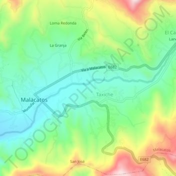
Name: Taxiche topographic map, elevation, terrain.
Location: Taxiche, Malacatos, Loja, 110061, Ecuador (-4.23812 -79.26248 -4.19812 -79.22248)
Average elevation: 1,611 m
Minimum elevation: 1,452 m
Maximum elevation: 1,885 m
Thank you for supporting this site ❤️
Make a donation
Make a donation
Gear up for your next adventure:
As an Amazon Associate, this site earns from qualifying purchases at no extra cost to you.