
Pentecost topographic map
Interactive map
Click on the map to display elevation.
Pentecost
The practice of grade-taking (the elevation of social status through the slaughter of valuable pigs) has been studied by anthropologists.
About this map
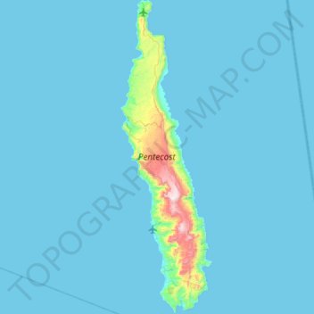
Name: Pentecost topographic map, elevation, terrain.
Location: Pentecost, Penama, Vanuatu (-16.01564 168.10947 -15.44854 168.28284)
Average elevation: 38 m
Minimum elevation: 0 m
Maximum elevation: 898 m