
Komma topographic map
Interactive map
Click on the map to display elevation.
About this map
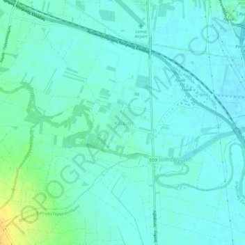
Name: Komma topographic map, elevation, terrain.
Average elevation: 12 m
Minimum elevation: 6 m
Maximum elevation: 32 m
Other topographic maps
Click on a map to view its topography, its elevation and its terrain.
Stavros
Greece > Thessaly and Central Greece > Phthiotis Regional Unit > Municipal Unit of Lamia
Average elevation: 84 m