
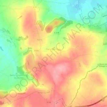
Placy-Montaigu topographic map
Interactive map
Click on the map to display elevation.
About this map
Name: Placy-Montaigu topographic map, elevation, terrain.
Average elevation: 174 m
Minimum elevation: 104 m
Maximum elevation: 230 m
Other topographic maps
Click on a map to view its topography, its elevation and its terrain.
Saint-Symphorien-les-Buttes
France > Normandie > Manche > Saint-Amand-Villages
Saint-Symphorien-les-Buttes, Saint-Amand-Villages, Saint-Lô, Manche, Normandie, France métropolitaine, 50160, France
Average elevation: 166 m
La Coudraie
France > Normandie > Manche > Saint-Amand-Villages > Saint-Amand > La Coudraie
La Coudraie, Saint-Amand, Saint-Amand-Villages, Saint-Lô, Manche, Normandie, France métropolitaine, 50160, France
Average elevation: 98 m