
Tamar topographic map
Interactive map
Click on the map to display elevation.
About this map
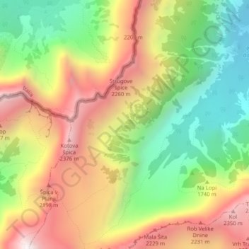
Name: Tamar topographic map, elevation, terrain.
Location: Tamar, Kranjska Gora, Slovenia (46.42833 13.69384 46.44696 13.71489)
Average elevation: 1,674 m
Minimum elevation: 1,070 m
Maximum elevation: 2,365 m
Other topographic maps
Click on a map to view its topography, its elevation and its terrain.