Geolocate

Cikuray topographic map

Click on the map to display elevation.

About this map

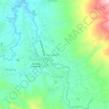
Name: Cikuray topographic map, elevation, terrain.

Location: Cikuray, Barusuda, Garut, West Java, Java, Indonesia (-7.37493 107.79880 -7.33196 107.82705)

Average elevation: 1,289 m

Minimum elevation: 1,176 m

Maximum elevation: 1,596 m

Gear up for your next adventure:

🗺️Ordnance Survey Maps - Official UK maps for walking and outdoor activities
🦯Walking Poles - Supportive poles for long-distance walking
🗺️Topographic Maps - Detailed maps showing elevation and terrain features
GPS Outdoor Watches - Watches with GPS tracking for hiking and exploration
👖Packable Overtrousers - Quick-deploy rain protection for legs in sudden storms

As an Amazon Associate, this site earns from qualifying purchases at no extra cost to you.