
Daxing District topographic map
Interactive map
Click on the map to display elevation.
About this map
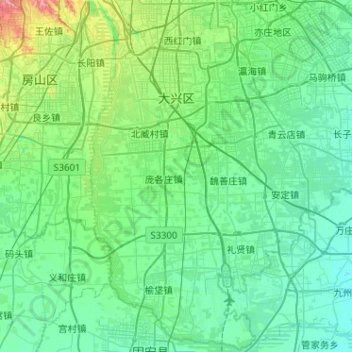
Name: Daxing District topographic map, elevation, terrain.
Location: Daxing District, Beijing, China (39.44161 116.20975 39.83082 116.72106)
Average elevation: 35 m
Minimum elevation: 18 m
Maximum elevation: 124 m
Other topographic maps
Click on a map to view its topography, its elevation and its terrain.
Jiugong
China > Beijing > Daxing District
Jiugong, Daxing District, Beijing, China
Average elevation: 37 m