
Sunshine Coast topographic map
Interactive map
Click on the map to display elevation.
About this map
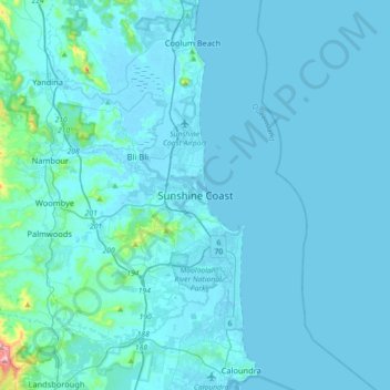
Name: Sunshine Coast topographic map, elevation, terrain.
Location: Sunshine Coast, Queensland, 4558, Australia (-26.81443 152.93337 -26.49443 153.25337)
Average elevation: 20 m
Minimum elevation: -3 m
Maximum elevation: 464 m
Other topographic maps
Click on a map to view its topography, its elevation and its terrain.
Buderim
Australia > Queensland > Sunshine Coast
Buderim, Sunshine Coast, Queensland, 4556, Australia
Average elevation: 32 m