
Horn Mill Spinney topographic map
Interactive map
Click on the map to display elevation.
About this map
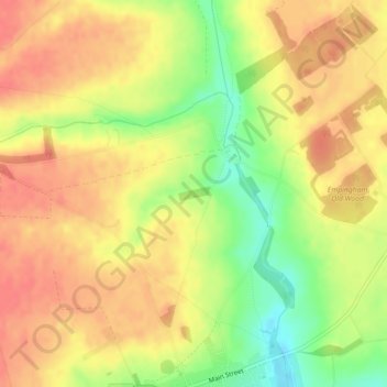
Name: Horn Mill Spinney topographic map, elevation, terrain.
Location: Horn Mill Spinney, Empingham, Rutland, England, United Kingdom (52.68029 -0.59822 52.68127 -0.59460)
Average elevation: 88 m
Minimum elevation: 51 m
Maximum elevation: 109 m