
Somali Peninsula topographic map
Interactive map
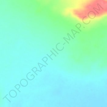
Click on the map to display elevation.
About this map
Name: Somali Peninsula topographic map, elevation, terrain.
Location: Somali Peninsula, Qardho District, Bari, Puntland, Somalia (9.83328 49.16662 9.83338 49.16672)
Average elevation: 840 m
Minimum elevation: 822 m
Maximum elevation: 894 m
In Somalia and Somaliland, there is not much seasonal variation in climate. Hot conditions prevail year-round along with periodic monsoon winds and irregular rainfall. Mean daily maximum temperatures range from 28 to 43 °C (82 to 109 °F), except at higher elevations along the eastern seaboard, where the effects of a cold offshore current can be felt. Somalia has only two permanent rivers, the Jubba and the Shabele, both of which begin in the Ethiopian Highlands.
Other topographic maps
Click on a map to view its topography, its elevation and its terrain.
Xaaji Khayr
Somalia > Bari > Qardho District
Xaaji Khayr, Qardho District, Bari, Puntland, Somalia
Average elevation: 660 m
Qardho
Somalia > Bari > Qardho District
Qardho, Qardho District, Bari, Puntland, Somalia
Average elevation: 779 m
Shire
Somalia > Bari > Qardho District
Shire, Qardho District, Bari, Puntland, Somalia
Average elevation: 695 m