
Thank you for supporting this site ❤️
Make a donation
Make a donation
Gear up for your next adventure:
As an Amazon Associate, this site earns from qualifying purchases at no extra cost to you.
Pantabangan topographic map
Click on the map to display elevation.
Thank you for supporting this site ❤️
Make a donation
Make a donation
Gear up for your next adventure:
As an Amazon Associate, this site earns from qualifying purchases at no extra cost to you.
About this map
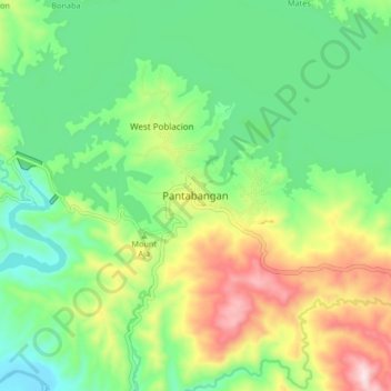
Name: Pantabangan topographic map, elevation, terrain.
Location: Pantabangan, Nueva Ecija, Central Luzon, 3124, Philippines (15.76739 121.10423 15.84739 121.18423)
Average elevation: 258 m
Minimum elevation: 104 m
Maximum elevation: 549 m
Thank you for supporting this site ❤️
Make a donation
Make a donation
Gear up for your next adventure:
As an Amazon Associate, this site earns from qualifying purchases at no extra cost to you.