
Thank you for supporting this site ❤️
Make a donation
Make a donation
Gear up for your next adventure:
As an Amazon Associate, this site earns from qualifying purchases at no extra cost to you.
Mazayjan topographic map
Click on the map to display elevation.
Thank you for supporting this site ❤️
Make a donation
Make a donation
Gear up for your next adventure:
As an Amazon Associate, this site earns from qualifying purchases at no extra cost to you.
About this map
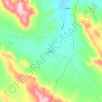
Name: Mazayjan topographic map, elevation, terrain.
Location: Mazayjan, بخش مزایجان, Bavanat County, Fars Province, Iran (30.25230 53.76239 30.33230 53.84239)
Average elevation: 2,330 m
Minimum elevation: 2,024 m
Maximum elevation: 2,954 m
Thank you for supporting this site ❤️
Make a donation
Make a donation
Gear up for your next adventure:
As an Amazon Associate, this site earns from qualifying purchases at no extra cost to you.