
Tixover topographic map
Interactive map
Click on the map to display elevation.
About this map
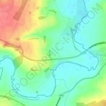
Name: Tixover topographic map, elevation, terrain.
Location: Tixover, Rutland, East Midlands, England, United Kingdom (52.58567 -0.57920 52.60836 -0.54263)
Average elevation: 52 m
Minimum elevation: 27 m
Maximum elevation: 95 m