
1899 topographic map
Interactive map
Click on the map to display elevation.
About this map
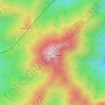
Name: 1899 topographic map, elevation, terrain.
Location: 1899, Aladağ, Adana, Akdeniz Bölgesi, Turquía (37.69721 35.44268 37.69731 35.44278)
Average elevation: 1,439 m
Minimum elevation: 1,030 m
Maximum elevation: 1,891 m