
Polarrajon topographic map
Interactive map
Click on the map to display elevation.
About this map
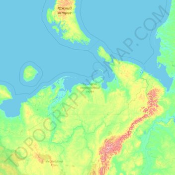
Name: Polarrajon topographic map, elevation, terrain.
Average elevation: 71 m
Minimum elevation: -3 m
Maximum elevation: 1,715 m
Other topographic maps
Click on a map to view its topography, its elevation and its terrain.
остров Колгуев
Russland > Autonomer Kreis der Nenzen
остров Колгуев, Autonomer Kreis der Nenzen, Föderationskreis Nordwest, Russland
Average elevation: 26 m