Kuno topographic map
Interactive map
Click on the map to display elevation.
About this map
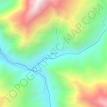
Name: Kuno topographic map, elevation, terrain.
Location: Kuno, Moorang, Kinnaur district, Himachal Pradesh, India (31.44670 78.55368 31.48670 78.59368)
Average elevation: 4,006 m
Minimum elevation: 3,419 m
Maximum elevation: 5,001 m
Other topographic maps
Click on a map to view its topography, its elevation and its terrain.
Ribba
India > Himachal Pradesh > Kinnaur district
Ribba, Moorang, Kinnaur district, Himachal Pradesh, 172116, India
Average elevation: 2,672 m
Sumra
India > Himachal Pradesh > Kinnaur district
Sumra, Hangrang, Kinnaur district, Himachal Pradesh, India
Average elevation: 3,635 m
Pooh
India > Himachal Pradesh > Kinnaur district
Pooh, Poo district, Kinnaur district, Himachal Pradesh, 172111, India
Average elevation: 3,067 m
Nako
India > Himachal Pradesh > Kinnaur district > Nako
Nako, Poo district, Kinnaur district, Himachal Pradesh, India
Average elevation: 3,608 m
Poo district
India > Himachal Pradesh > Kinnaur district
Poo district, Kinnaur district, Himachal Pradesh, India
Average elevation: 4,373 m