
Thank you for supporting this site ❤️
Make a donation
Make a donation
Gear up for your next adventure:
As an Amazon Associate, this site earns from qualifying purchases at no extra cost to you.
Salvacion topographic map
Click on the map to display elevation.
Thank you for supporting this site ❤️
Make a donation
Make a donation
Gear up for your next adventure:
As an Amazon Associate, this site earns from qualifying purchases at no extra cost to you.
About this map
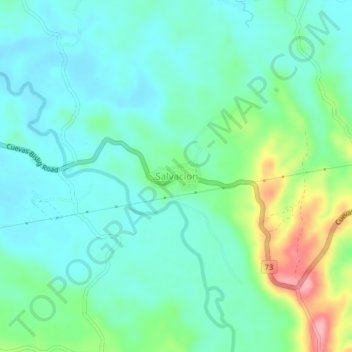
Name: Salvacion topographic map, elevation, terrain.
Location: Salvacion, Trento, Agusan del Sur, Caraga, 8505, Philippines (7.99041 126.10230 8.03041 126.14230)
Average elevation: 77 m
Minimum elevation: 46 m
Maximum elevation: 168 m
Thank you for supporting this site ❤️
Make a donation
Make a donation
Gear up for your next adventure:
As an Amazon Associate, this site earns from qualifying purchases at no extra cost to you.