
Riverton topographic map
Interactive map
Click on the map to display elevation.
About this map
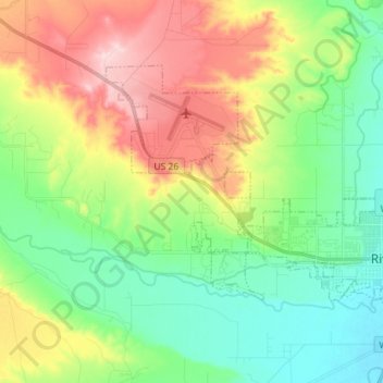
Name: Riverton topographic map, elevation, terrain.
Location: Riverton, Fremont County, Wyoming, 82501, United States (43.00874 -108.48887 43.07737 -108.34620)
Average elevation: 1,529 m
Minimum elevation: 1,470 m
Maximum elevation: 1,669 m
Other topographic maps
Click on a map to view its topography, its elevation and its terrain.
Gannett Peak
United States > Wyoming > Fremont County
Gannett Peak is the highest mountain peak in the U.S. state of Wyoming at 13,810 feet (4,210 m). It lies in the Wind River Range within the Bridger Wilderness of the Bridger-Teton National Forest. Straddling the Continental Divide along the boundary between Fremont and Sublette counties, it has the second…
Average elevation: 3,700 m