
Tiara topographic map
Interactive map
Click on the map to display elevation.
About this map
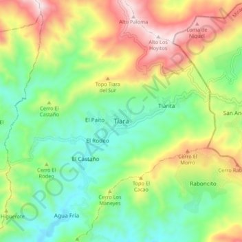
Name: Tiara topographic map, elevation, terrain.
Location: Tiara, Aragua, Venezuela (10.09026 -67.19574 10.17026 -67.11574)
Average elevation: 885 m
Minimum elevation: 582 m
Maximum elevation: 1,382 m