

Venezuela topographic maps
Click on a map to view its topography, its elevation and its terrain.
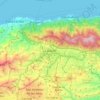
Caracas
Venezuela > Capital District > Caracas
Cerro El Ávila (Mountain El Ávila) (Indigenous name: Waraira Repano), is a mountain in the mid-North of Venezuela. It rises next to Caracas and separates the city from the Caribbean Sea; The area's highest elevation is Pico Naiguatá, at 2,765 metres (9,072 ft) above sea level. It is considered the lungs of…
Average elevation: 858 m

Guiana Highlands
Venezuela > Bolivar State > Municipio Angostura
The Guiana Shield (French: Plateau des Guyanes, Bouclier guyanais; Dutch: Hoogland van Guyana, Guianaschild; Portuguese: Planalto das Guianas, Escudo das Guianas; Spanish: Escudo guayanés) is one of the three cratons of the South American Plate. It is a 1.7 billion-year-old Precambrian geological formation in…
Average elevation: 524 m
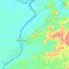


Maturin
Venezuela > Monagas State > Municipio Maturín
Maturin is located at 67 meters of altitude and 520 kilometres from the country's capital, Caracas. It is right next to the Guarapiche River and is a crossroad for roads towards the center, the Caribbean coast and the Orinoco River
Average elevation: 58 m


Parroquia San Juan Bautista
Venezuela > Tachira State > Municipio San Cristóbal
Average elevation: 1,269 m


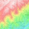


Parroquia San Antonio de los Altos
Venezuela > Miranda State > Municipio Los Salias
San Antonio de los Altos is part of the Altos Mirandinos Metropolitan Area, which is, in itself part of the Metropolitan Region of Caracas. It covers an area of about 55 km2 (21 sq mi) and has an average altitude of 1,300 metres (4,300 ft) above sea level. San Antonio is the highest point in the Altos…
Average elevation: 1,240 m


Zaraza
Venezuela > Guarico State > Municipio Zaraza
Zaraza is located on the northeastern edge of the state of Guárico, on the crossroads of Troncal 13 and Troncal 14. Its average elevation is 52 meters above the sea level.
Average elevation: 52 m


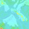




Laguna de Las Peonias
Venezuela > Zulia State > Municipio Mara > Santa Cruz de Mara
Average elevation: 3 m


Topo La Florida
Venezuela > Aragua State > Municipio Santos Michelena > La Florida
Average elevation: 980 m


Parroquia Santos de Abelgas
Venezuela > Delta Amacuro State > Municipio Antonio Díaz
Average elevation: 6 m


Archipiélago Los Hermanos
Venezuela > Federal Dependencies > Archipiélago Los Hermanos
Average elevation: 0 m


Parque Metropolitano Laguna de Las Peonías
Venezuela > Zulia State > Municipio Mara > Santa Cruz de Mara
Average elevation: 1 m
