
Bel Air topographic map
Interactive map
Click on the map to display elevation.
About this map
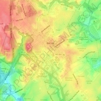
Name: Bel Air topographic map, elevation, terrain.
Location: Bel Air, Harford County, Maryland, 21014, United States (39.51292 -76.36807 39.55243 -76.32372)
Average elevation: 103 m
Minimum elevation: 52 m
Maximum elevation: 140 m
Other topographic maps
Click on a map to view its topography, its elevation and its terrain.