
Hérémence topographic map
Interactive map
Click on the map to display elevation.
About this map
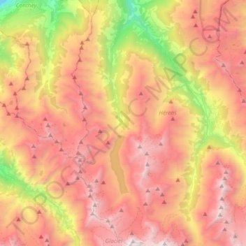
Name: Hérémence topographic map, elevation, terrain.
Location: Hérémence, Hérens, Wallis, 1987, Switzerland (45.98956 7.34424 46.19210 7.44278)
Average elevation: 2,329 m
Minimum elevation: 475 m
Maximum elevation: 3,846 m
Other topographic maps
Click on a map to view its topography, its elevation and its terrain.
Les Maresses
Switzerland > Wallis > Hérens > Mont-Noble > Vernamiège
Les Maresses, Vernamiège, Mont-Noble, Hérens, Wallis, 1961, Switzerland
Average elevation: 1,657 m
Baule
Switzerland > Wallis > Hérens > Saint-Martin (VS) > St-Martin VS
Baule, St-Martin VS, Saint-Martin (VS), Hérens, Wallis, 1969, Switzerland
Average elevation: 1,439 m
Lac de Tseuzier
Switzerland > Wallis > Hérens > Ayent
Lac de Tseuzier, Ayent, Hérens, Wallis, 1966, Switzerland
Average elevation: 1,871 m
Schnidehorn
Switzerland > Wallis > Hérens > Ayent
Schnidehorn, Ayent, Hérens, Wallis, 1966, Switzerland
Average elevation: 2,566 m
Ayent
Switzerland > Wallis > Hérens
Ayent, Hérens, Wallis, 1966, Switzerland
Average elevation: 1,781 m
Nax
Switzerland > Wallis > Hérens > Mont-Noble
Nax, Mont-Noble, Hérens, Wallis, 1973, Switzerland
Average elevation: 990 m
Bonnefille
Switzerland > Wallis > Hérens > Ayent > Anzère
Bonnefille, Anzère, Ayent, Hérens, Wallis, 1972, Switzerland
Average elevation: 1,408 m
Wildhorn
Switzerland > Wallis > Hérens > Ayent
Wildhorn, Ayent, Hérens, Wallis, 1966, Switzerland
Average elevation: 2,768 m
Pigne d'Arolla
Switzerland > Wallis > Hérens > Evolène
Pigne d'Arolla, Evolène, Hérens, Wallis, 1983, Switzerland
Average elevation: 3,280 m
Aiguilles Rouges d'Arolla
Switzerland > Wallis > Hérens > Evolène
Aiguilles Rouges d'Arolla, Evolène, Hérens, Wallis, 1983, Switzerland
Average elevation: 3,091 m
Place de Son La Forclaz
Switzerland > Wallis > Hérens > La Forclaz > Place de Son La Forclaz
Place de Son La Forclaz, La Forclaz, Evolène, Hérens, Wallis, 1983, Switzerland
Average elevation: 1,862 m
Farquèses
Switzerland > Wallis > Hérens > Les Haudères > Farquèses
Farquèses, Les Haudères, Evolène, Hérens, Wallis, 1983, Switzerland
Average elevation: 1,908 m
Anzère
Switzerland > Wallis > Hérens > Ayent
Anzère, Ayent, Hérens, Wallis, 1972, Switzerland
Average elevation: 1,493 m
Dent Blanche
Switzerland > Wallis > Hérens > Evolène
Dent Blanche, Evolène, Hérens, Wallis, 1983, Switzerland
Average elevation: 3,458 m