
Masonville topographic map
Interactive map
Click on the map to display elevation.
About this map
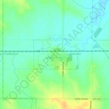
Name: Masonville topographic map, elevation, terrain.
Location: Masonville, Delaware County, Iowa, United States (42.47648 -91.59819 42.48382 -91.58345)
Average elevation: 309 m
Minimum elevation: 297 m
Maximum elevation: 330 m
Other topographic maps
Click on a map to view its topography, its elevation and its terrain.
Earlville
United States > Iowa > Delaware County
Earlville, Delaware County, Iowa, United States
Average elevation: 310 m
Delaware
United States > Iowa > Delaware County > Delaware
Delaware, Delaware County, Iowa, 52036, United States
Average elevation: 322 m