
Frøya topographic map
Interactive map
Click on the map to display elevation.
About this map
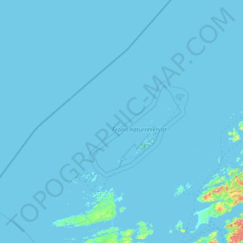
Name: Frøya topographic map, elevation, terrain.
Location: Frøya, Trøndelag, Norway (63.59815 7.64810 64.54729 9.73186)
Average elevation: 4 m
Minimum elevation: -1 m
Maximum elevation: 476 m
Other topographic maps
Click on a map to view its topography, its elevation and its terrain.