Geolocate

Kirtipur topographic map

Interactive map

Click on the map to display elevation.

About this map

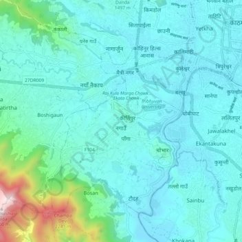
Name: Kirtipur topographic map, elevation, terrain.

Location: Kirtipur, Kathmandu, Bagmati Pradesh, 44618, Nepal (27.63666 85.23824 27.71666 85.31824)

Average elevation: 1,414 m

Minimum elevation: 1,258 m

Maximum elevation: 2,487 m

Other topographic maps

Click on a map to view its topography, its elevation and its terrain.

Namgyal

Nepal > Kathmandu

Namgyal, Gokarneshwar Municipality, Kathmandu, 46603, Nepal

Average elevation: 1,366 m

Kathmandu

Nepal > Kathmandu

Kathmandu, Bagmati Pradesh, Nepal

Average elevation: 1,335 m

Tokha

Nepal > Kathmandu

Tokha, Kathmandu, Bagmati Pradesh, Nepal

Average elevation: 1,547 m

Kirtipur

Nepal > Kathmandu

Kirtipur, Kathmandu, Bagmati Pradesh, 44618, Nepal

Average elevation: 1,380 m