
Jonesborough topographic map
Interactive map
Click on the map to display elevation.
About this map
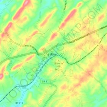
Name: Jonesborough topographic map, elevation, terrain.
Average elevation: 543 m
Minimum elevation: 497 m
Maximum elevation: 601 m
Other topographic maps
Click on a map to view its topography, its elevation and its terrain.
Montcastle Hills
United States > Tennessee > Washington County > Johnson City
Average elevation: 506 m
East Ridge
United States > Tennessee > Washington County > Johnson City > East Ridge
Average elevation: 509 m
Carnegie
United States > Tennessee > Washington County > Johnson City > Carnegie
Average elevation: 505 m