
Steinsel topographic map
Interactive map
Click on the map to display elevation.
About this map
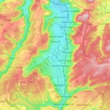
Name: Steinsel topographic map, elevation, terrain.
Location: Steinsel, Canton Luxembourg, Luxembourg (49.64130 6.08219 49.69231 6.21481)
Average elevation: 328 m
Minimum elevation: 220 m
Maximum elevation: 440 m
Other topographic maps
Click on a map to view its topography, its elevation and its terrain.
Luxembourg City: Old Quarters & Fortifications
Luxembourg > Canton Luxembourg > Luxembourg
Average elevation: 294 m