
Boxford topographic map
Interactive map
Click on the map to display elevation.
About this map
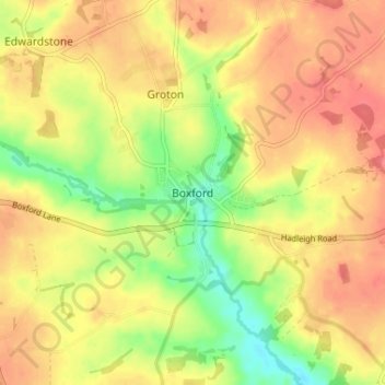
Name: Boxford topographic map, elevation, terrain.
Location: Boxford, Babergh, Suffolk, England, CO10 5DX, United Kingdom (52.00919 0.83980 52.04919 0.87980)
Average elevation: 53 m
Minimum elevation: 19 m
Maximum elevation: 75 m
Suffolk trails, hiking, mountain biking, running and outdoor activities
Other topographic maps
Click on a map to view its topography, its elevation and its terrain.
Long Melford-Bury St Edmunds branch line
United Kingdom > England > Suffolk > Babergh > Lavenham
Average elevation: 70 m