
Rae vald topographic map
Interactive map
Click on the map to display elevation.
About this map
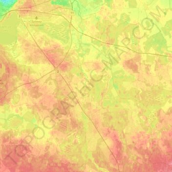
Name: Rae vald topographic map, elevation, terrain.
Location: Rae vald, Harju maakond, Estonia (59.22854 24.76054 59.43550 25.11811)
Average elevation: 44 m
Minimum elevation: 11 m
Maximum elevation: 65 m
Other topographic maps
Click on a map to view its topography, its elevation and its terrain.