
Higashiomi topographic map
Interactive map
Click on the map to display elevation.
About this map
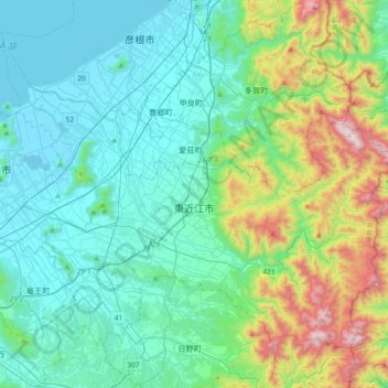
Name: Higashiomi topographic map, elevation, terrain.
Location: Higashiomi, Shiga Prefecture, Japan (35.01377 136.08523 35.25184 136.45504)
Average elevation: 323 m
Minimum elevation: 81 m
Maximum elevation: 1,239 m