
Dunalley topographic map
Interactive map
Click on the map to display elevation.
About this map
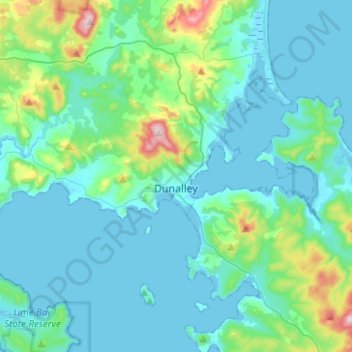
Name: Dunalley topographic map, elevation, terrain.
Location: Dunalley, Sorell, Tasmania, Australia (-42.92486 147.72733 -42.84209 147.97717)
Average elevation: 62 m
Minimum elevation: -2 m
Maximum elevation: 416 m
Other topographic maps
Click on a map to view its topography, its elevation and its terrain.