
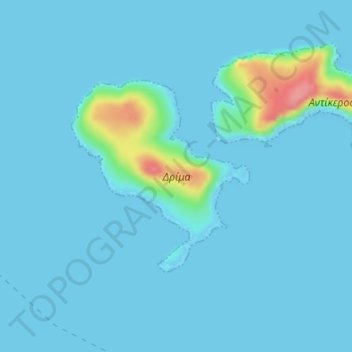
Drima topographic map
Interactive map
Click on the map to display elevation.
About this map
Name: Drima topographic map, elevation, terrain.
Average elevation: 8 m
Minimum elevation: 0 m
Maximum elevation: 91 m
Other topographic maps
Click on a map to view its topography, its elevation and its terrain.
Oia
Greece > Aegean > Thira Regional Unit > Ia Municipal Unit
The village is located on top of a hill, at about 150 m (500 ft) elevation, and known as the "Eagles nest" from where Palia and Nea Kameni volcanoes are seen and also the island of Therasia. It is situated to the north of the island and Fira is at distance of 11 km (7 mi). The main street in the town, in the…
Average elevation: 20 m
Fanes
Greece > Aegean > Rhodes Regional Unit
Fanes (Greek: Φάνες) is a village in the northeast part of Rhodes. The main village is situated around 1 km inland, at an average elevation of 46 meters above the sea level.
Average elevation: 46 m