
Fort Stockton topographic map
Interactive map
Click on the map to display elevation.
About this map
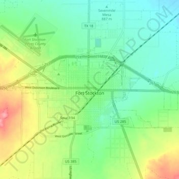
Name: Fort Stockton topographic map, elevation, terrain.
Location: Fort Stockton, Pecos County, Texas, 79735, United States (30.87565 -102.92784 30.91085 -102.84087)
Average elevation: 910 m
Minimum elevation: 878 m
Maximum elevation: 972 m
Other topographic maps
Click on a map to view its topography, its elevation and its terrain.