
Leckhampton topographic map
Interactive map
Click on the map to display elevation.
About this map
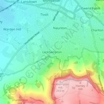
Name: Leckhampton topographic map, elevation, terrain.
Average elevation: 118 m
Minimum elevation: 46 m
Maximum elevation: 293 m
Gloucestershire trails, hiking, mountain biking, running and outdoor activities
Other topographic maps
Click on a map to view its topography, its elevation and its terrain.
Timbercombe
United Kingdom > England > Gloucestershire > Cheltenham > Charlton Kings
Average elevation: 159 m