
Franklin Township topographic map
Interactive map
Click on the map to display elevation.
About this map
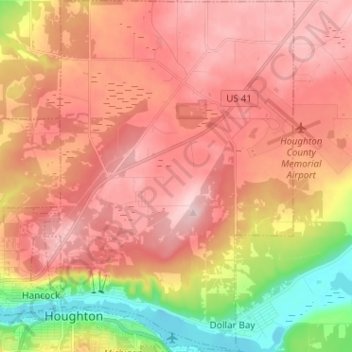
Name: Franklin Township topographic map, elevation, terrain.
Location: Franklin Township, Houghton County, Michigan, United States (47.11286 -88.58364 47.19960 -88.48914)
Average elevation: 298 m
Minimum elevation: 177 m
Maximum elevation: 373 m
Other topographic maps
Click on a map to view its topography, its elevation and its terrain.
Lake Linden
United States > Michigan > Houghton County
Lake Linden, Schoolcraft Township, Houghton County, Michigan, 49945, United States
Average elevation: 206 m
Hancock
United States > Michigan > Houghton County
Hancock, Houghton County, Michigan, 49930, United States
Average elevation: 276 m