Geolocate

Tamura topographic map

Interactive map

Click on the map to display elevation.

About this map

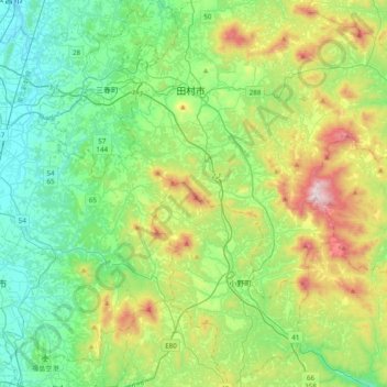
Name: Tamura topographic map, elevation, terrain.

Location: Tamura, Fukushima Prefecture, Japan (37.20365 140.42350 37.51148 140.69384)

Average elevation: 479 m

Minimum elevation: 205 m

Maximum elevation: 1,179 m

Other topographic maps

Click on a map to view its topography, its elevation and its terrain.

Iwaki

Japan > Fukushima Prefecture

Iwaki, Fukushima Prefecture, Japan

Average elevation: 204 m

Koriyama

Japan > Fukushima Prefecture

Koriyama, Fukushima Prefecture, Japan

Average elevation: 480 m