
Seram Island topographic map
Interactive map
Click on the map to display elevation.
About this map
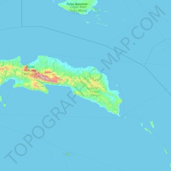
Name: Seram Island topographic map, elevation, terrain.
Location: Seram Island, Maluku, Indonesia (-3.87547 127.83763 -2.77299 130.88224)
Average elevation: 41 m
Minimum elevation: 0 m
Maximum elevation: 2,962 m
Other topographic maps
Click on a map to view its topography, its elevation and its terrain.
Batas Desa Dian Pulau Kec Kei Kecil Barat Kabupaten Maluku Tenggara
Indonesia > Maluku > Maluku Tenggara
Average elevation: 6 m