
Southampton topographic map
Interactive map
Click on the map to display elevation.
About this map
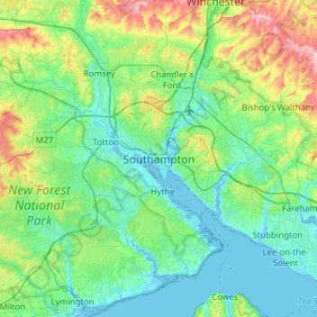
Name: Southampton topographic map, elevation, terrain.
Location: Southampton, South East, England, SO14 2BY, United Kingdom (50.74253 -1.56419 51.06253 -1.24419)
Average elevation: 38 m
Minimum elevation: -5 m
Maximum elevation: 179 m
England trails, hiking, mountain biking, running and outdoor activities
Other topographic maps
Click on a map to view its topography, its elevation and its terrain.