
Saijo topographic map
Interactive map
Click on the map to display elevation.
About this map
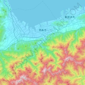
Name: Saijo topographic map, elevation, terrain.
Location: Saijo, Ehime Prefecture, Japan (33.75030 132.95671 34.00895 133.27736)
Average elevation: 477 m
Minimum elevation: -3 m
Maximum elevation: 1,912 m