
Rotonda topographic map
Interactive map
Click on the map to display elevation.
About this map
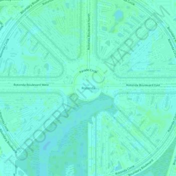
Name: Rotonda topographic map, elevation, terrain.
Location: Rotonda, Charlotte County, Florida, 33947, United States (26.87195 -82.29239 26.91195 -82.25239)
Average elevation: 4 m
Minimum elevation: 1 m
Maximum elevation: 6 m
Other topographic maps
Click on a map to view its topography, its elevation and its terrain.
Punta Gorda
United States > Florida > Charlotte County
Punta Gorda features a predominantly flat topography characterized by its low elevation, averaging around 7 to 10 feet above sea level. The terrain is primarily made up of coastal plains and wetlands, interspersed with small hills such as those found in South Punta Gorda Heights, which can reach elevations of…
Average elevation: 3 m
Port Charlotte
United States > Florida > Charlotte County
Port Charlotte is characterized by a predominantly flat and low-lying terrain, typical of Florida’s coastal landscape. The area features a network of waterways, including the Peace River and Charlotte Harbor, which provide ample opportunities for recreational activities like boating and fishing. Elevations…
Average elevation: 4 m
South Gulf Cove Park
United States > Florida > Charlotte County > Port Charlotte
Average elevation: 3 m
South Gulf Cove Park
United States > Florida > Charlotte County > Port Charlotte
Average elevation: 3 m
Heritage Lake Park Community Development District
United States > Florida > Charlotte County
Average elevation: 7 m
Peace River Preserve
United States > Florida > Charlotte County > Punta Gorda > Harbour Heights
Average elevation: 3 m
Harbour Heights
United States > Florida > Charlotte County > Punta Gorda > Harbour Heights
Average elevation: 4 m
Gilcrest Park
United States > Florida > Charlotte County > Punta Gorda > Fishermens Village
Average elevation: 2 m