
Eastern Province topographic map
Interactive map
Click on the map to display elevation.
About this map
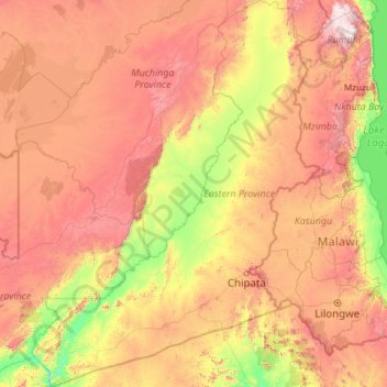
Name: Eastern Province topographic map, elevation, terrain.
Location: Eastern Province, Zambia (-14.99658 29.95292 -11.59088 33.54855)
Average elevation: 981 m
Minimum elevation: 382 m
Maximum elevation: 1,866 m
Other topographic maps
Click on a map to view its topography, its elevation and its terrain.