
Grizedale topographic map
Interactive map
Click on the map to display elevation.
About this map
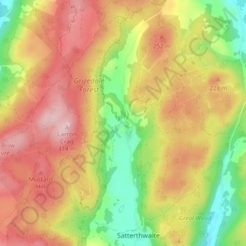
Name: Grizedale topographic map, elevation, terrain.
Average elevation: 186 m
Minimum elevation: 55 m
Maximum elevation: 304 m
Other topographic maps
Click on a map to view its topography, its elevation and its terrain.
High Dale Park
United Kingdom > England > Westmorland and Furness > Satterthwaite
High Dale Park, Satterthwaite, Westmorland and Furness, England, LA12 8LJ, United Kingdom
Average elevation: 140 m