
Kuala Kangsar topographic map
Interactive map
Click on the map to display elevation.
About this map
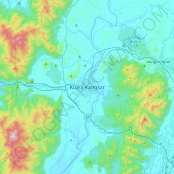
Name: Kuala Kangsar topographic map, elevation, terrain.
Location: Kuala Kangsar, Perak, 33000, Malaysia (4.61207 100.78088 4.93207 101.10088)
Average elevation: 283 m
Minimum elevation: 23 m
Maximum elevation: 1,616 m
Other topographic maps
Click on a map to view its topography, its elevation and its terrain.
Kampung Baru Simpang Pulai
Malaysia > Perak > Kg. Baru Simpang Pulai > Kampung Baru Simpang Pulai
Average elevation: 54 m