
Somerset topographic map
Interactive map
Click on the map to display elevation.
About this map
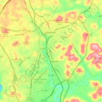
Name: Somerset topographic map, elevation, terrain.
Location: Somerset, Pulaski County, Kentucky, United States (37.03135 -84.64756 37.12006 -84.56484)
Average elevation: 295 m
Minimum elevation: 202 m
Maximum elevation: 398 m
Other topographic maps
Click on a map to view its topography, its elevation and its terrain.