
Athi topographic map
Interactive map
Click on the map to display elevation.
About this map
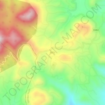
Name: Athi topographic map, elevation, terrain.
Location: Athi, Igembe South, Meru County, Eastern, Kenya (0.15054 37.90148 0.19054 37.94148)
Average elevation: 1,591 m
Minimum elevation: 1,315 m
Maximum elevation: 1,915 m
Other topographic maps
Click on a map to view its topography, its elevation and its terrain.
Kaathene
Kenya > Meru County > Igembe South
Kaathene, Igembe South, Meru County, Eastern, Kenya
Average elevation: 1,797 m